GIS Analytics
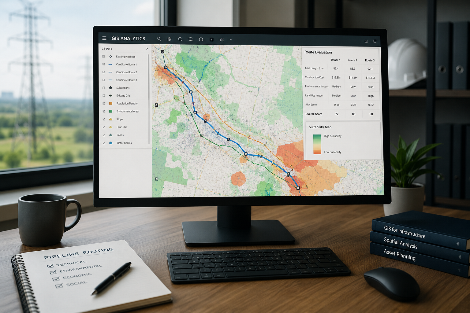
Geospatial analysis for pipeline routing, grid expansion and asset planning, helping energy teams connect terrain, infrastructure, demand and risk data into location-aware decisions.
What It Is
GIS analytics applies spatial data processing, mapping, network analysis and location intelligence to energy infrastructure decisions. It allows planners, engineers and operations teams to evaluate where assets are located, how they interact with terrain and communities, and which routing or expansion options are operationally feasible.
In energy use cases, GIS analytics is not only a mapping layer. It combines satellite imagery, cadastral data, rights-of-way, environmental constraints, asset registries, load forecasts and operational telemetry to support route selection, grid reinforcement, field execution and long-term asset strategy.
Key Pain Points
Energy infrastructure projects depend on many location-based constraints that are often stored in disconnected systems. GIS analytics helps make these dependencies visible before planning errors become expensive field changes.
Data Sources and Core Areas
GIS analytics integrates structured asset data with spatial context. The quality of routing or planning outputs depends on data freshness, coordinate accuracy, layer governance and clear ownership of critical source systems.
| Source Type | Typical Data | Planning Value |
|---|---|---|
| Asset repositories | Pipelines, cables, substations, valves, towers, meters, compressor stations and inspection records. | Shows existing infrastructure position, topology, condition and dependencies. |
| Terrain and remote sensing | Elevation models, satellite imagery, LiDAR, slope, flood zones, vegetation and land cover. | Supports feasibility checks, construction constraints and environmental screening. |
| Network and demand data | Load forecasts, generation points, interconnection requests, service territories and grid capacity limits. | Connects spatial planning with operational needs and future demand growth. |
| External constraints | Land parcels, roads, protected areas, population density, permit zones and rights-of-way. | Helps reduce routing risk, approval delays and avoidable redesign work. |
Workflow
A typical GIS analytics workflow combines spatial ingestion, validation, modelling and decision publication. The goal is to create a repeatable planning process rather than one-off map production.
Methods, Architecture and Controls
GIS analytics becomes more useful when spatial methods are connected to governed data pipelines, traceable assumptions and decision controls.
Use Cases and Operational Impact
GIS analytics supports infrastructure planning decisions where location, timing, risk and asset dependencies must be evaluated together.
| Use Case | GIS Analytics Role | Operational Impact |
|---|---|---|
| Pipeline routing | Compares route alternatives against slope, crossings, land ownership, environmental zones and existing corridors. | Improves route screening and reduces avoidable redesign during engineering and permitting. |
| Grid expansion | Links demand growth, distributed generation, substation capacity and physical site constraints. | Supports better sequencing of reinforcement projects and interconnection planning. |
| Asset planning | Maps asset condition, criticality, outage exposure, field access and proximity to hazards. | Helps prioritize replacement, inspection and maintenance programs by location-based risk. |
| Emergency readiness | Combines asset maps with weather, wildfire, flood, population and access-route layers. | Improves situational awareness for response planning and field coordination. |
Key Performance Metrics
Metrics should evaluate whether GIS analytics improves decision quality, planning speed and operational readiness. They should not be limited to map production volume.
Limitations & Practical Considerations
GIS analytics improves spatial decision support, but it does not remove the need for engineering judgement, field verification, land access review or regulatory interpretation. Spatial outputs should be treated as decision evidence, not final approval.
Common limitations include outdated layers, missing asset coordinates, incompatible projections, inconsistent naming, limited metadata and uncertainty in external datasets. Teams should document assumptions and avoid over-precision when source data is incomplete.
Related Deep Dives
GIS analytics connects closely with data governance, asset repositories, load analytics and energy infrastructure planning workflows.