Oil & Gas Exploration Intelligence
Oil and gas exploration uses indirect measurements, geological interpretation and computational models to estimate what lies beneath the surface. Modern workflows combine seismic imaging, inversion, rock physics and uncertainty analysis to reduce exploration risk and improve subsurface decision-making.
Exploration Pain Points
Exploration decisions are difficult because the subsurface cannot be observed directly. Operators rely on seismic waves, well logs, rock samples and geological assumptions to build models that are always incomplete and uncertain.
The main objective is not to remove uncertainty entirely. It is to understand where uncertainty is highest, which assumptions drive the model and whether the remaining risk is acceptable before major capital decisions are made.
Seismic Imaging & Inversion
Seismic imaging uses controlled or natural wave propagation to infer subsurface structures. Reflected and refracted waves are recorded at the surface and processed into images that represent geological interfaces and velocity variations.
Seismic inversion goes one step further: it attempts to transform seismic responses into quantitative estimates of rock properties such as impedance, velocity, density or porosity. These outputs support reservoir characterization but remain dependent on assumptions, calibration data and model quality.
| Concept | Purpose | Typical Challenge |
|---|---|---|
| Seismic imaging | Maps subsurface structures and reflectors | Noise, resolution limits and complex wave paths |
| Seismic inversion | Estimates physical rock properties from seismic response | Non-unique solutions and calibration dependency |
| Well-log calibration | Anchors seismic interpretation to measured subsurface data | Sparse coverage and local bias |
Full Waveform Inversion
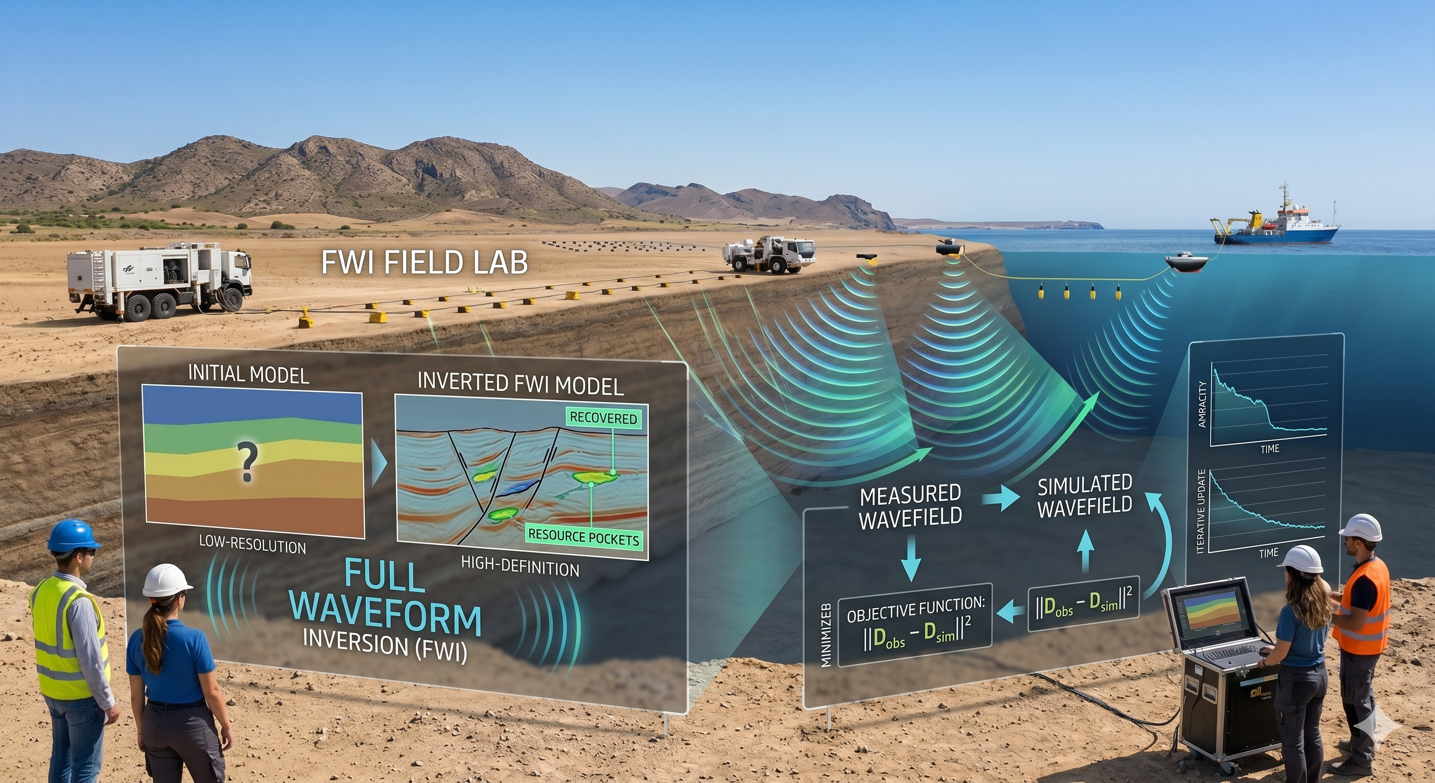
Full Waveform Inversion is an advanced seismic inversion technique that uses the full recorded seismic waveform rather than only selected arrival times or simplified attributes. It iteratively updates a subsurface velocity model until simulated wavefields better match measured seismic data.
FWI can provide high-resolution subsurface models, especially in structurally complex regions. However, it is computationally intensive and sensitive to starting models, acquisition geometry, low-frequency data availability and noise.
Digital Rock Physics
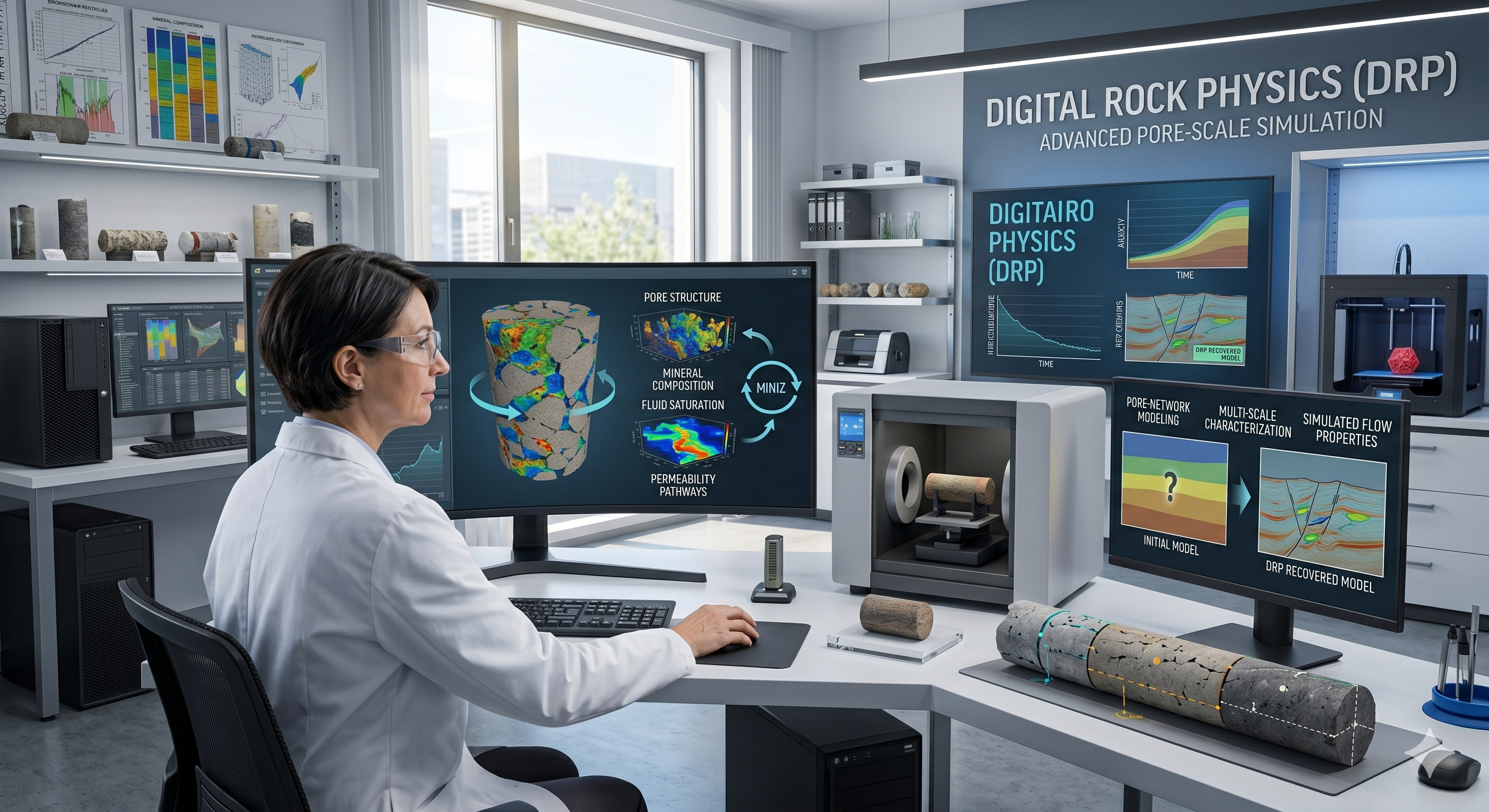
Digital Rock Physics uses high-resolution imaging of rock samples, such as micro-CT scans, to reconstruct pore networks and simulate physical rock behavior. It supports the estimation of porosity, permeability, saturation behavior and fluid flow at the pore scale.
DRP is especially useful when laboratory tests are slow, expensive or limited by sample availability. Machine learning can support image segmentation, property prediction and upscaling from pore-scale simulations to reservoir-scale models.
Integrated Exploration Workflow
The strongest exploration workflows combine multiple evidence layers. Seismic inversion provides a regional view, well logs anchor interpretation, and digital rock physics connects micro-scale rock behavior with reservoir-scale assumptions.
AI can support this process by detecting patterns, accelerating interpretation and quantifying uncertainty. It should be used as a decision-support layer, not as a replacement for geological and geophysical expertise.
| Layer | Function | Examples |
|---|---|---|
| Acquisition layer | Collects raw subsurface evidence | Seismic surveys, well logs, core samples |
| Processing layer | Transforms raw signals into interpretable data | Migration, denoising, inversion, segmentation |
| Model layer | Builds geological and physical representations | Velocity models, facies models, pore-scale models |
| Decision layer | Supports drilling and reservoir evaluation decisions | Prospect ranking, uncertainty maps, risk assessment |
Key Performance Metrics
Exploration workflows are evaluated through model quality, uncertainty reduction, interpretation speed and decision impact.
Limitations & Practical Considerations
Subsurface models are always uncertain because they are built from indirect and incomplete measurements. More computation does not automatically mean more truth. The quality of the result depends on data quality, acquisition design, calibration, geological realism and expert interpretation.
Advanced techniques such as FWI and Digital Rock Physics are most valuable when integrated into a broader exploration workflow with uncertainty quantification, well validation and transparent assumptions.